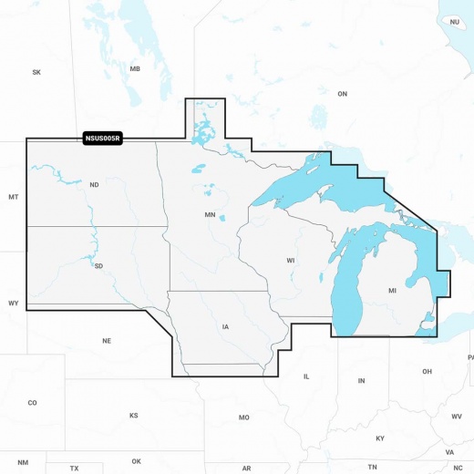
Garmin Navionics+ NSUS005R U.S. North & Great Lakes Chart Card
SKU: CWR-92671
- Unparalleled detail and accuracy for offshore and inland waters
- Integrated mapping of coastal waters, lakes, rivers, and more with SonarChart 1’ (0.5 meters) HD bathymetry maps
- Dock-to-dock route guidance technology, live mapping, and Plotter Sync for wireless access to daily updates
- Multiple shading options for navigating shallow waters with confidence
- Community Edits and SonarChart Live mapping feature for creating personal 1’ HD bathymetry maps in real-time
Unit Price
Quantity
Subtotal
US$ 224.95
US$ 224.95
US$ 223.601%
2
Description
With the Navionics+ NSUS005R, you'll have access to integrated mapping of coastal waters, lakes, rivers, and more, with SonarChart 1’ (0.5 meters) HD bathymetry maps that provide incredibly detailed imagery of the seafloor. The advanced features of this chart card don't stop there - you'll also enjoy dock-to-dock route guidance technology, live mapping, and Plotter Sync, which provides wireless access to daily updates, ensuring you always have the freshest chart data at your fingertips.
Whether you're a seasoned angler or a novice boater, the Navionics+ NSUS005R has got you covered. With multiple shading options, you'll be able to navigate shallow waters with confidence and easily highlight the best fishing spots. Plus, with the fishing range advanced feature, you can highlight a user-defined target depth range, making it easier than ever to reel in the big catch.
But that's not all - the Navionics+ NSUS005R also offers Community Edits, a valuable feature that allows you to download and view local information contributed by Navionics Boating app users on your compatible chartplotter. This feature ensures that you'll always have the most up-to-date information on the best fishing spots, hidden hazards, and more. And with the SonarChart Live mapping feature, you'll be able to create new personal 1’ HD bathymetry maps in real-time, giving you an unparalleled level of detail and accuracy.
The Garmin Navionics+ NSUS005R is compatible with a range of Garmin chartplotters, including the Echomap UHD, GPSmap, and more. Plus, with worldwide coverage available, you'll be able to explore new waters with confidence. And with the Navionics Chart Installer software, you'll be able to easily update your charts and ensure that you always have the latest and greatest data at your fingertips.
Don't settle for anything less - choose the Garmin Navionics+ NSUS005R for the ultimate in marine navigation. With its unparalleled level of detail, advanced features, and seamless integration with your Garmin chartplotter, this chart card is the perfect choice for any boater looking to take their navigation to the next level.
Shipping specs
Shipping from
This product is shipped from our supplier's warehouse in NJ, United States
Our guarantee
This product is brand new and includes the manufacturer's warranty, so you can buy with confidence.
Return policy
A 25% handling charge is levied against all authorized returns except those due to our error. Unauthorized returns are subject to a 40% handling charge. Damages & defects must be reported to us within 14 days. Product questions