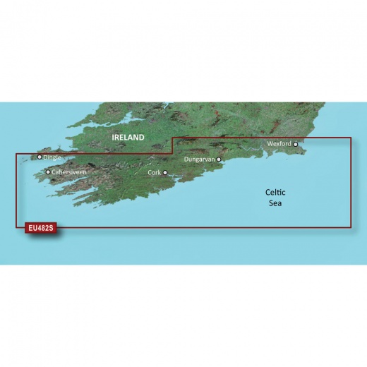
Garmin Bluechart G3 Vision HD - VEU482S - Wexford to Dingle Bay - MicroSD/SD
SKU: CWR-30794
Out of stock
Out of stock
- Industry-leading coverage and clarity with integrated Garmin and Navionics content
- Auto Guidance calculates a suggested route based on your desired depth and overhead clearance
- Depth Range Shading displays high-resolution shading for up to 10 depth ranges
- 1’ contours provide a more accurate depiction of bottom structure
- FishEye View provides a 3-D representation of the underwater world
Options
Description
With the Garmin Bluechart g3 Vision HD, you'll enjoy industry-leading coverage and clarity, thanks to the integrated Garmin and Navionics content. This chartplotter card boasts an array of innovative features, including Auto Guidance, which calculates a suggested route based on your desired depth and overhead clearance. This feature is perfect for planning your journey, ensuring you avoid obstacles and navigate safely.
In addition to Auto Guidance, the Garmin Bluechart g3 Vision HD features Depth Range Shading, which displays high-resolution shading for up to 10 depth ranges. This allows you to easily identify your target depth at a glance, giving you the confidence to navigate even the most challenging waters. Shallow Water Shading is another valuable feature, enabling you to customize the shading to your desired depth, providing a clear picture of shallow waters to avoid.
The Garmin Bluechart g3 Vision HD also includes 1’ contours, providing a more accurate depiction of bottom structure, perfect for improving your fishing charts and enhancing detail in swamps, canals, and port plans. High-resolution satellite imagery is seamlessly integrated with navigational charts, giving you a realistic view of your surroundings, ideal for entering unfamiliar harbors or ports.
But that's not all - the Garmin Bluechart g3 Vision HD also features FishEye View, which provides a 3-D representation of the underwater world, giving you a unique perspective on the seafloor. MarinerEye View offers a 3-D representation of the surrounding area, both above and below the waterline, providing a comprehensive understanding of your environment. Aerial Photography completes the package, offering crystal-clear imagery of many ports, harbors, and marinas, ideal for navigating new territories.
In short, the Garmin Bluechart g3 Vision HD is the ultimate marine navigation solution, designed to provide unmatched coverage, clarity, and detail. By combining cutting-edge features with Garmin's renowned expertise, this chartplotter card is the perfect choice for anyone seeking a premium navigation experience. Elevate your boating adventures today with the Garmin Bluechart g3 Vision HD.
Shipping specs
Shipping from
This product is shipped from our supplier's warehouse in NJ, United States
Our guarantee
This product is brand new and includes the manufacturer's warranty, so you can buy with confidence.
Return policy
A 25% handling charge is levied against all authorized returns except those due to our error. Unauthorized returns are subject to a 40% handling charge. Damages & defects must be reported to us within 14 days. Product questions