Garmin Bluechart G3 Vision HD - VCA008R - Newfoundland West MicroSD/SD
SKU: CWR-30388
Out of stock
Out of stock
- Unparalleled coverage and brilliant detail for a more precise and safe journey
- Integrated Garmin and Navionics content for exceptional clarity and detail
- Auto Guidance for a suggested route, taking into account your desired depth and overhead clearance
- Innovative Depth Range Shading for unparalleled visibility and control
- Shallow Water Shading feature for added safety and High-resolution satellite imagery for a realistic view of your surroundings
Options
Description
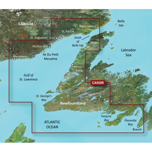
Covering the western and southern coast of Newfoundland from the Strait of Belle Isle to Placentia Bay, including St. George's Bay and Fortune Bay, as well as the coasts of Quebec and Labrador from La Romaine to Red Bay, this chart provides an extensive coverage area for your maritime adventures. With Auto Guidance, simply select a spot, and the system will provide a suggested route, taking into account your desired depth and overhead clearance, ensuring a safe and efficient journey.
One of the standout features of the Garmin Bluechart g3 Vision HD is its innovative Depth Range Shading, which allows you to view your target depth at a glance. This feature displays high-resolution shading for up to 10 depth ranges, giving you unparalleled visibility and control. Additionally, the Shallow Water Shading feature provides a clear picture of shallow waters to avoid, allowing you to set a user-defined depth for added safety.
The level of detail in these charts is unmatched, with 1’ contours providing a more accurate depiction of bottom structure for improved fishing charts and enhanced detail in swamps, canals, and port plans. High-resolution satellite imagery is also integrated into these charts, giving you a realistic view of your surroundings and making it ideal for entering unfamiliar harbors or ports. Furthermore, with FishEye View, you can see an underwater perspective of the seafloor, and with MarinerEye View, you can see a 3-D representation of the surrounding area both above and below the waterline.
The Garmin Bluechart g3 Vision HD also features aerial photography, providing crystal-clear images of many ports, harbors, and marinas. This feature is ideal when entering unfamiliar ports, allowing you to navigate with confidence. With its industry-leading coverage, clarity, and detail, this chart is the perfect companion for any maritime adventure.
Experience the ultimate in navigation technology with the Garmin Bluechart g3 Vision HD - VCA008R - Newfoundland West. Whether you're a seasoned sailor or a beginner, this advanced chart will provide you with the confidence and precision you need to navigate the waters with ease.
Shipping specs
Shipping from
This product is shipped from our supplier's warehouse in NJ, United States
Our guarantee
This product is brand new and includes the manufacturer's warranty, so you can buy with confidence.
Return policy
A 25% handling charge is levied against all authorized returns except those due to our error. Unauthorized returns are subject to a 40% handling charge. Damages & defects must be reported to us within 14 days. Product questions