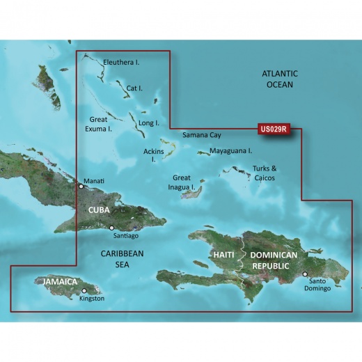
Garmin Bluechart G3 Vision HD - VUS029R Chart Card for Southern Bahamas
SKU: CWR-30375
Out of stock
Out of stock
- Unparalleled coverage and brilliant detail of the Southern Bahamas
- Auto Guidance feature calculates a route based on desired depth and overhead clearance
- High-resolution relief shading for a clearer view of bottom structure
- Up to 1’ contours for improved fishing charts and navigation
- High-resolution satellite imagery for detailed images of ports and landmarks
Options
Description
With the BlueChart g3 Vision coastal charts, you'll experience industry-leading coverage, clarity, and detail, thanks to the integration of Garmin and Navionics data. The Auto Guidance feature uses your desired depth and overhead clearance to calculate a route and suggest a path to follow, making navigation easier than ever. Plus, with high-resolution relief shading, you'll get a clearer view of bottom structure than with contour lines alone.
But that's not all - this chart card also features up to 1’ contours, providing a more accurate depiction of the bottom structure for improved fishing charts and navigation in swamps, canals, and marinas. And with Depth Range Shading, you can view your target depth at a glance, with up to 10 depth ranges to choose from. Shallow Water Shading also allows you to designate the shallow water depths you need to avoid, ensuring your safety on the water.
The Garmin Bluechart g3 Vision HD - VUS029R also includes high-resolution satellite imagery, providing detailed images of ports, marinas, bridges, and navigational landmarks. This, combined with 3-D views, including MarinerEye and FishEye views, gives you a unique perspective both above and below the water line. Whether you're a seasoned sailor or just starting out, this chart card is the perfect tool to help you navigate the waters of the Southern Bahamas with confidence.
The BlueChart g3 Vision HD - VUS029R is compatible with Garmin chart plotters, making it easy to plan and navigate your route. And, with the ActiveCaptain app, you can even access NOAA raster cartography for a more traditional paper chart look and feel.
Don't settle for anything less than the best - choose the Garmin Bluechart g3 Vision HD - VUS029R chart card for your next marine adventure. With its unparalleled coverage, brilliant detail, and innovative features, you'll be able to explore the waters of the Southern Bahamas like never before.
Shipping specs
Shipping from
This product is shipped from our supplier's warehouse in NJ, United States
Our guarantee
This product is brand new and includes the manufacturer's warranty, so you can buy with confidence.
Return policy
A 25% handling charge is levied against all authorized returns except those due to our error. Unauthorized returns are subject to a 40% handling charge. Damages & defects must be reported to us within 14 days. Product questions