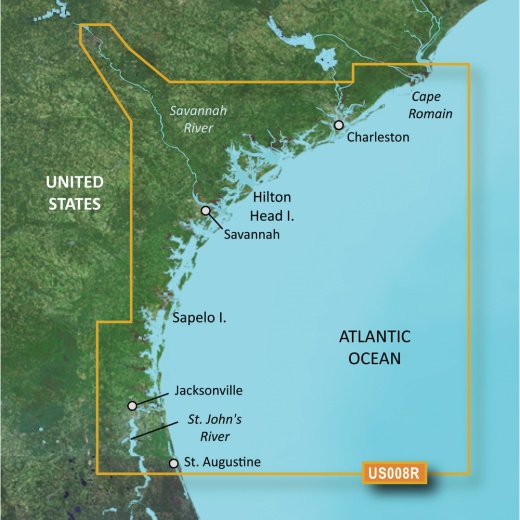
Garmin Bluechart G3 Vision HD - VUS008R - Charleston to Jacksonville microSD/SD Chart
SKU: CWR-30362
Out of stock
Out of stock
- Unparalleled coverage and clarity for confident coastal navigation
- Industry-leading data and Navionics integration for accurate and up-to-date charts
- Auto Guidance feature for easy route planning with desired depth and overhead clearance
- High-resolution relief shading for a clearer view of bottom structure
- Innovative features like Depth Range Shading, Shallow Water Shading, and high-resolution satellite imagery
Options
Description
With Garmin's industry-leading data and Navionics integration, you'll have access to the most accurate and up-to-date charts available. The BlueChart g3 Vision coastal charts offer brilliant detail and unparalleled coverage, making it easier to navigate even the most complex coastal waters. Plus, with the Auto Guidance feature, you can plan your route with ease, using your desired depth and overhead clearance to calculate a suggested path to follow.
But that's not all - the BlueChart g3 Vision HD also features high-resolution relief shading, which combines color and shadow to give you an easy-to-interpret, clearer view of bottom structure than contour lines alone. This means you'll have a more accurate depiction of the seafloor, making it easier to find the best fishing spots and navigate through swamps, canals, and marinas. And with up to 1-foot contours, you'll have an even more accurate picture of the seafloor.
The Garmin Bluechart g3 Vision HD also includes a range of innovative features to enhance your navigation experience. Depth Range Shading provides up to 10 depth ranges, allowing you to quickly identify your target depth. Shallow Water Shading helps you avoid shallow waters, and high-resolution satellite imagery provides detailed views of ports, marinas, bridges, and navigational landmarks. Plus, with MarinerEye and FishEye views, you'll have a unique perspective both above and below the waterline.
Whether you're a seasoned navigator or just starting out, the Garmin Bluechart g3 Vision HD is the ultimate tool for anyone looking to explore the coastal waters. With its unparalleled coverage, clarity, and innovative features, you'll have everything you need to navigate with confidence. And with Garmin's commitment to excellence, you can trust that this chart will provide you with the most accurate and up-to-date information available.
So why settle for anything less? Upgrade your navigation experience with the Garmin Bluechart g3 Vision HD - VUS008R - Charleston to Jacksonville - microSD/SD chart. With its unparalleled coverage, clarity, and innovative features, you'll be able to navigate the coastal waters with ease and confidence. Experience the ultimate in coastal navigation today.
Shipping specs
Shipping from
This product is shipped from our supplier's warehouse in NJ, United States
Our guarantee
This product is brand new and includes the manufacturer's warranty, so you can buy with confidence.
Return policy
A 25% handling charge is levied against all authorized returns except those due to our error. Unauthorized returns are subject to a 40% handling charge. Damages & defects must be reported to us within 14 days. Product questions