Garmin Navionics Vision+ NVEU051R Chart - Norway Marine Chart
SKU: CWR-96380
Out of stock
Out of stock
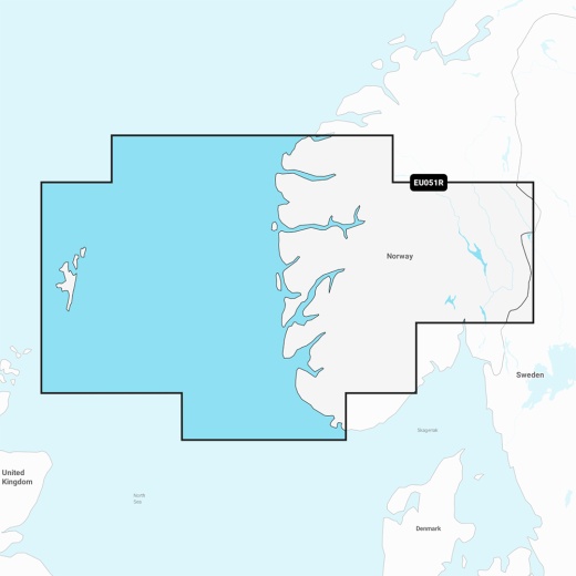
- Detailed coverage of the Norway coast from Farsund to Maloy, including the Shetland Islands and the Sognefjord
- Compatible with a range of Garmin chartplotters for seamless navigation
- Access to the world's most advanced marine mapping with vibrant colors and streamlined interface
- Fully customizable with various chart layers, overlay combinations, and up to 10 color-shaded target depth ranges
- One-year subscription included with daily chart updates via the ActiveCaptain app
Description
With the Navionics Vision+ NVEU051R chart, you'll have access to the world's most advanced marine mapping, featuring vibrant colors, a streamlined interface, and combined coastal and inland content. The chart's popular Navionics style color palette makes it easy to plot your course, while multiple shading options aid in shallow water navigation and make it easy to highlight a target depth range for the best fishing spots.
The chart's fully customizable with various chart layers, overlay combinations, and up to 10 color-shaded target depth ranges, allowing you to scope out the best fishing spots with ease. Plus, with a one-year subscription included, you'll receive daily chart updates via the ActiveCaptain app, ensuring you have access to the most up-to-date and accurate marine mapping.
The Garmin Navionics Vision+ NVEU051R chart offers a range of innovative features, including Auto Guidance+ technology, which provides a suggested dock-to-dock path to follow through channels, inlets, marina entrances, and more. You'll also benefit from depth range shading, which lets you select up to 10 color-shaded options and view your designated target depths at a glance.
With up to 1' contours, you'll have a clear depiction of bottom structure for improved fishing and navigation, while shallow water shading provides a clear picture of shallow waters to avoid. The chart also features a range of community-sourced content from the ActiveCaptain community, providing useful points of interest such as marinas, anchorages, hazards, businesses, and more.
The Garmin Navionics Vision+ NVEU051R chart offers unparalleled situational awareness, with downloadable high-resolution satellite imagery, aerial photography, 3D Fisheye View, and 3D Marinereye View, providing a comprehensive understanding of your surroundings both above and below the waterline. Whether you're a seasoned navigator or just starting out, this chart is the perfect tool to help you navigate Norway's stunning coastline with confidence.
Shipping specs
Shipping from
This product is shipped from our supplier's warehouse in NJ, United States
Our guarantee
This product is brand new and includes the manufacturer's warranty, so you can buy with confidence.
Return policy
A 25% handling charge is levied against all authorized returns except those due to our error. Unauthorized returns are subject to a 40% handling charge. Damages & defects must be reported to us within 14 days. Product questions