Garmin Navionics+ NSSA004L Chart - Mexico, The Caribbean To Brazil - Inland & Coastal Marine Chart
SKU: CWR-96095
Out of stock
Out of stock
- Experience the ultimate in marine navigation with premium cartography and daily chart updates
- Comprehensive coverage area, including Mexico, Central America, Brazil, and more
- Features Auto Guidance+ technology for suggested dock-to-dock paths
- High-resolution depth range shading and shallow water shading for improved navigation
- Compatible with Garmin chartplotters and available on MicroSD/SD card format
Description
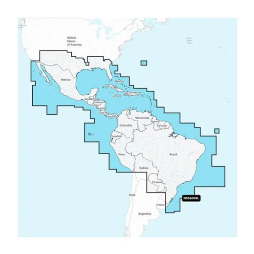
The Garmin Navionics+ NSSA004L chart offers a comprehensive coverage area, including Mexico, Central America, Brazil, the US Gulf Coast, and the eastern US coast to Savannah, GA; Bermuda; the Bahamas; Cuba; Hispaniola; Puerto Rico and the Virgin Islands; the Windward and Leeward Islands; Jamaica; the Panama Canal, the western coast of South America to Arica, Chile; the Galapagos Islands; the Revillagigedo Islands; the Ilha Fernando de Noronha; the Saint Peter and Saint Paul Archipelago and the Rocas Atoll. This all-in-one map solution provides access to detail-rich mapping of coastal features, lakes, rivers, and more, making it an essential tool for boaters, fishermen, and water sports enthusiasts.
With daily chart updates via the ActiveCaptain app, you can trust that your Garmin Navionics+ chart is always current and accurate. The one-year included subscription ensures that you have access to the latest chart updates, with up to 5,000 updates made every day. This means you can focus on the water, knowing that your chart is always up-to-date and reliable.
The Garmin Navionics+ NSSA004L chart also features Auto Guidance+ technology, which provides a suggested dock-to-dock path to follow through channels, inlets, marina entrances, and more. Additionally, the chart offers high-resolution depth range shading, allowing you to select up to 10 color-shaded options and view your designated target depths at a glance. With up to 1' contours, you'll have a clear depiction of bottom structure for improved fishing charts and enhanced detail in swamps, canals, harbors, marinas, and more.
Shallow water shading allows you to select a user-defined depth, providing a clear picture of shallow waters to avoid. The chart also includes community-sourced content from the ActiveCaptain community, providing useful POIs such as marinas, anchorages, hazards, businesses, and more. Get recommendations from boaters with firsthand experience of the local environment, making your boating experience even more enjoyable and safe.
With Garmin Navionics+ cartography, you can trust that you're getting the best possible navigation solution for your compatible chartplotter. The chart is compatible with Garmin chartplotters and is available on a MicroSD/SD card format. Invest in the Garmin Navionics+ NSSA004L chart today and experience the ultimate in marine navigation.
Shipping specs
Shipping from
This product is shipped from our supplier's warehouse in NJ, United States
Our guarantee
This product is brand new and includes the manufacturer's warranty, so you can buy with confidence.
Return policy
A 25% handling charge is levied against all authorized returns except those due to our error. Unauthorized returns are subject to a 40% handling charge. Damages & defects must be reported to us within 14 days. Product questions